

Contents · 5 sections
For some 80 kilometres, the Route des Crêtes runs along the crest line of the Vosges mountains, at altitudes between 900 and more than 1,300 metres. Flower-strewn high pastures, mountain lakes, legendary summits and First World War memorial sites: it is one of the most beautiful scenic roads in eastern France. Here is how to make the most of the route, stop by stop.
At a glance
Where to stay in Alsace
Compare hotels for your dates before they fill up.
View on ExpediaPartner links.
A road born of the First World War
The Route des Crêtes was not built for tourists. The French army began building it in 1915 to link and supply its positions on the Vosges front without going through the exposed valleys. Its course deliberately follows the western slope, on the Lorraine side, just below the ridge: convoys were sheltered there from the German artillery positioned on the Alsace side. After the war, the road was opened to traffic and became the main tourist route of the High Vosges.
The route and its unmissable stops
Depending on the starting points chosen, it is said to be between 77 and 88 kilometres long. It links the area around the Col des Bagenelles and the Col du Bonhomme, above Sainte-Marie-aux-Mines, with Uffholtz, near Cernay. From north to south, don’t miss:
- The Lac Blanc and Gazon du Faing area: high pastures, plunging views over the glacial lakes and lovely easy walks.
- The Col de la Schlucht (1,139 m): a historic crossing point between Alsace and Lorraine and the starting point for many trails.
- The Hohneck (1,363 m): one of the highest summits of the range, with an exceptional panorama over the glacial cirques and the Munster and Vologne valleys.
- The Markstein: a mountain resort known for its ski slopes in winter and its wide open spaces in summer.
- The Grand Ballon (1,424 m): the highest point of the Vosges, about a fifteen-minute walk from the car park, with the Blue Devils monument (Diables Bleus) and a viewpoint indicator.
- The Hartmannswillerkopf or Vieil Armand (956 m): a major First World War site, designated a national monument, with its military cemetery, its trenches and the Franco-German Historial.
Book an activity in Alsace
All activities via GetYourGuideGuided tours in AlsacePrices and dates on the partner siteBook
 via GetYourGuideDay trips from StrasbourgPrices and dates on the partner siteBook
Partner links: if you book through these links, Alsace Voyage earns a commission at no extra cost to you.
Food stops and fermes-auberges
All along the road, fermes-auberges (farm inns) welcome visitors up on the high pastures from late spring to autumn. Many serve the traditional repas marcaire (meat pie, smoked pork collar, roïgabrageldi potatoes, munster cheese and dessert), a legacy of the marcaires, the herdsmen who took their cattle up to the ridges for the summer. Opening days and seasons vary from farm to farm, so check ahead and book, especially at weekends.
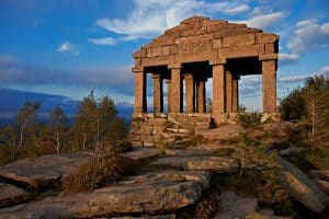 Read nextThe sacred mountain of Donon: a story thousands of years old
On foot, by bike or by motorbike
The Route des Crêtes is first and foremost a road, but it is the ideal starting point for many hikes. The GR5, waymarked by the Club Vosgien, partly follows the ridge line and passes the Hohneck and the Grand Ballon. For a shorter outing, park at a pass and walk up to a nearby summit: the views rarely take more than an hour’s walk to reach. Discover our ideas for hikes in the great outdoors.
The road also attracts many cyclists and motorcyclists: ride carefully, as there are plenty of bends and fog can come down quickly. You are also crossing the Ballons des Vosges Regional Nature Park: stay on the waymarked trails, keep your dog on a lead and respect the peace of the wildlife and pastures.
When to go and practical tips
- Season: the road closes every winter, usually from mid-November until spring (it often reopens in April, depending on snow cover). Several sections are affected, notably between the Col des Bagenelles and the Col du Bonhomme, between the Rainkopf and the Markstein, and between the Markstein and the Grand Ballon. Check the notices from the Collectivité européenne d’Alsace before setting off.
- Best time: May to October. Late May and June for the flowering pastures, September and October for autumn colours and days of exceptional visibility, when you can sometimes see the Alps.
- What to bring: even in summer, pack a warm, windproof jacket; on the ridges it is much colder than in the plain. From 1 November to 31 March, winter equipment is compulsory on mountain roads.
- How long: allow at least half a day by car with a few stops, ideally a full day to hike and have lunch at a ferme-auberge.
On your way back down, why not carry on to the wine villages of the plain? The Alsace Wine Route is only a few kilometres from the first valleys.

Enzo
Hi, I'm Enzo! I'm the guy who loves lacing up his hiking boots to explore the rugged trails of the Vosges. Passionate about nature and photography, I take you along through articles that capture the scent of fir forests and the charm of mountain lakes. I live for those moments when the sun rises over the Haut-Koenigsbourg or when I stumble upon an authentic inn along the way. My goal? To inspire you to get out, breathe in the fresh Alsatian air, and always have a great spot for a tarte flambée to share at the end of the day.
 Vosges & Great ValleysExplorer breathtaking natural landscapes to escape